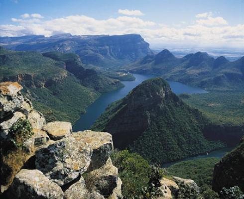

The Panorama Route is a scenic route along Mpumalanga Escarpment with Blyde River Canyon, the third largest canyon in the world, central to it.
On entering the Panoramic Route via Long Tom Pass from Lydenburg, at 2,149 metres above sea-level you travel along the highest tarred road in South Africa. It gets its name from the cannons used by the Boers against the British in 1900.
From the crest of Mount Anderson look down 1,000 metres to South Africa's largest man made forest and the town of Sabie which boasts the largest sawmill in South Africa.
Visit the Sabie Forestry Museum and see the three spectacular waterfalls, Horse Shoe, Lone Creek, and Bridal Veil. Between Sabie and Graskop you pass Mac Mac Falls.
Pilgrims Rest is an old gold mining town frozen in time, now a national museum with an opportunity to try your hand at gold panning.
Graskop, situated on the magnificent Drakensburg Escarpment above Kowyn's Pass, is the gateway to Blyde River Canyon, the Pinnacle, God's Window, Lisbon and Berlin Falls, Bourke's Luck Potholes and the Three Rondavels.
Descend through the Abel Erasmus Pass to Blyde River Canyon to enjoy a barge cruise on the dam.
Just before Acornhoek is the wildlife rehabilitation centre Mholo Holo.
Hazyview is the springboard to the Kruger National Park and the world famous private reserve Sabi Sand. A visit to the Shangana Cultural Village, with its Marula Market featuring exquisite craftwork, its day tours and its evening festivities, is a "must".
White River is part of a sub route of potters, artists, furniture craftsmen and sculptors called the Artists' Route.
