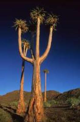
In June 2007, the "Richtersveld Cultural and Botanical Landscape", just to the south of the Ai-Ais Richtersveld National Park and an area of equivalent size and beauty, was named a UNESCO World Heritage Site.
Unlike the National Park, the Richtersveld Community Conservancy, which forms the core zone of the World Heritage Site, is not subject to diamond mining and is as a result the more pristine of the two areas.
The Richtersveld Cultural and Botanical Landscape of dramatic mountainous desert constitutes a cultural landscape communally owned and managed. This heritage site sustains the semi-nomadic pastoral livelihood of the Nama people, reflecting seasonal patterns that may have persisted for as much as two millennia in southern Africa.
Located in northern Namaqualand, the arid Namaqua National Park represents a harsh landscape where water is a great scarcity and only the hardiest of lifeforms survive. Despite this, the Richtersveld is regarded as the only Arid Biodiversity Hotspot on Earth, with an astonishing variety of plant, bird and animal life (much of which is endemic).
Characterised by extreme temperatures, the communally run landscape affords a semi-nomadic pastoral livelihood for the Nama people, descendants of the Khoisan people who once occupied lands across southern Namibia and most of the present-day Western and Northern Cape provinces of South Africa.
Khoisan is a term used to describe two separate groups, physically similar in being light-skinned and small in stature. The Khoi, who were called Hottentots by the Europeans, were pastoralists and were effectively annihilated; the San, called Bushmen by the Europeans, were hunter-gatherers. A small San population still lives in South Africa.
It is the only area where the Nama still construct portable rush-mat houses (haru om) and includes seasonal migrations and grazing grounds, together with stock posts. The pastoralists collect medicinal and other plants and have a strong oral tradition associated with different places and attributes of the landscape.
"The extensive communal grazed lands bear testimony to the land management processes which have ensured the protection of the succulent Karoo vegetation," the World Heritage Committee noted. "This demonstrates a harmonious interaction between people and nature."
