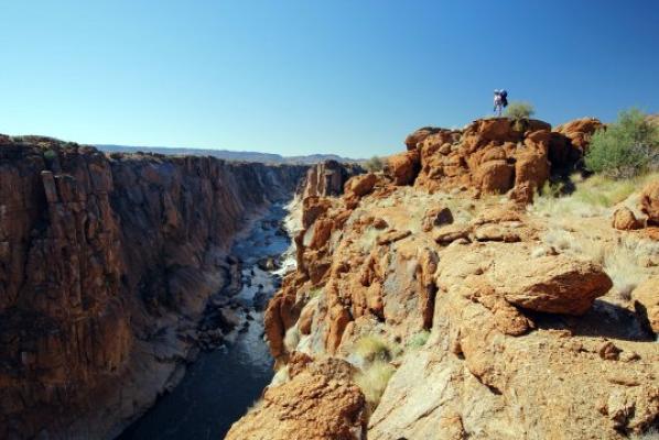

This 39.5 km hike takes three days with two overnights in rustic huts and starting at the restcamp at the Augrabies Falls National Park - north west of Kakamas. A detailed map is available at the office.
The huts contain 12 bunk beds with mattresses, toilets, drinking water, fire wood, and basic cooking/braaing utensils (1 water pot, 1 potjie pot, and one braai grill). No electricity or showers are provided. Fires may be lit only in the fireplaces built for this purpose. Hikers must provide their own sleeping bags, torches/candles, and crockery and cutlery.
Accommodation for the nights prior to, and upon completion of, the hike are not included in the trail reservation and must be reserved separately.
Theres no better way to truly experience the geology, flora, and fauna of Augrabies Falls National Park than hiking through the heartland of the park itself. The Klipspringer Hiking Trail offers an opportunity to do just that with 39.5km of some of the most beautiful scenery youll find in the Northern Cape. After visiting the mighty Augrabies Falls, embark on one of the most breathtaking and satisfying journeys available in this part of South Africa.
The Klipspringer Hiking Trail consists of three days of hiking. The first day is 14km long; the second day, 13km; and the last day, 12.5km. Though the first day is the longest, the second day is typically the most difficult regarding the heat, while the third day is the least demanding. As the hike is quite demanding, its necessary to plan for quite a rigorous trip.
Because this is a semi-arid area, the trail is sometimes difficult to follow without using the trail markers and cairns.
Day 1 starts at the Reception area. Follow the signs to the campground. Continue along the main road through the campground to the farthest northwestern corner. Look just beyond the building on the edge of the campground, and youll see a big green sign which marks the beginning of the hiking trails. From here, the trail roughly follows along the rim of the gorge to the Visarend Hut (Fish Eagle Hut) which
is approximately 1.5km from Oranjekom.
Day 2 begins with a short climb up the hill behind the hut before heading down a small valley into the gorge. Its recommended to walk slightly above the Orange River for the first couple kilometers in the gorge to avoid boulderclimbing right along the waters edge. The trail follows the Orange River approximately 8km.
Along the way, youll come across the Augrabies Falls National Park canoe put-in point. The sixth dry river bed you reach after the canoe put-in point is quite large, and this is the one that will lead you to the hut. At the confluence of three dry river beds, you take the river bed to the left. Follow this main river bed, and when it takes a 90 degree turn to the right, you are
only about 1km from the Berg Hut (Mountain Hut). Continue following the river bed, but move to the left side just above the bank where youll encounter a dirt road. While following the road, keep a close eye to your left: the hut is visible through a small saddle.
Day 3 follows the dirt road for a short while before heading towards the Swart Rante (Black Ridges). After crossing the Swart Rante, the trail follows along the road periodically until reaching Moon Rock. At Moon Rock, you have the option of climbing over the top of Moon Rock or walking along the base of it on the right side.
After Moon Rock, you meet up with the Dassie Interpretive Trail for approximately the last 2.5km before reaching the Rest Camp. When you encounter the low-water crossing, follow the trail to the left: its not necessary to take off your shoes and wade unless you want to cool off!
This trail is closed from 15 October to 31 March.
General
- Permit and map of route
- Pencil and paper
- Sun Glasses
- Binovulars
- Mobile phone
- Camera
Essentials
- Matches
- Backpack
- Sleeping bag
- Torch and extra batteries
- Pocket knife
- Water bottle
- Water purification tablets
- Cooking and eating utensils
- Crockery
Clothing
- Cap and sunscreen
- Two sets of light clothes
- One sweater or warm jacket
- Hiking Boots
- Four pairs of thick socks
- Light rainproof jacket
- Shower shoes for evenings
Food
- Dried fruit sand vegetables
- Glucose sweets & chocolate
- Peanut butter
- Tinned meat and fish
- Instant soup mix
- Instant mashed potatoes
- Vacuum-packed meat (for braaing)
- Trail mix
- Coffe, tea and sports drink
- Muesli and rusks
First Aid Kit
- Headache tablets
- Rehydration packs
- Lip protectant
- Blister guards
- Antiseptic salve
- Insect repellent
- Bandage and plasters
- After-sun treatment
- Disinfectant


