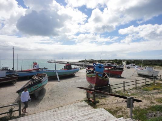

Struisbaai and Agulhas is situated in the southernmost region of South Africa, where the Indian and Atlantic oceans meet and Struisbaai is situated just four kilometers from Cape L'Agulhus. The two towns can easily be mistaken as one.
Struisbaai is well known for its long 14km uninterrupted white beach which is very safe for a walk and swimming. The Struisbaai harbour often is a good inspiration for artists and photographers.
This area is also well-known for its angling and fishing, and if you are an early bird, you will see masses of red bait which washed ashore during the night lyaing on the beach. This is a good bait if you want to catch South Africa's national fish, the Galjoen.
There is some debate as to the origin of the name Struisbaai. Some authorities believe that it means Straw Bay, after the fishermens cottages that were originally built of straw.
Others claim the name Struisbaai is derived from the Dutch vogelstruijs or ostrich. The low shrub-covered terrain bordering the sandy coast is certainly ostrich country and there are a good number of these giant birds sharing the land with dairy cattle and merino sheep.
Still others say that the town is named for the size of its beach - from an old Dutch word for huge.
The water is crystal clear and its brilliant colour is exaggerated by the colourful boats which reside in the harbour. There is a lovely little seafood restaurant at the harbour where you can dine on some freshly caught fish whilst watching the picturesque scene of the locals bartering with fishermen for their daily catch.
There is also remains of ancient stone fish traps used by the Khoisan people, which were made by packing layers of rocks around shallower pools in which fish were then trapped and collected during the different tides.
Southern Right whales visit from June to December to calve and mate.
The ocean is rich in scuba diving wrecks with many to choose from. Various artefacts collected from the wrecked ships along this coastline have been placed in the Shipwreck museum in Breadasdorp.


