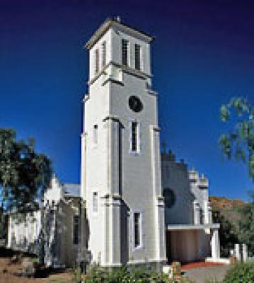
Rietpoort is situated 28km northwest of Bitterfontein in the Namaqualand region of the West Coast. It can be reached via a good gravel road.
It was established by a Dutch Catholic Missionary, Father Cornelius van't Westeinde who arrived here in 1913. He spent his forst 18 months in the area in a cave just outside the town, which can still be visited today. He began his ministry in the open air before a church was constructed.
The beautiful cathedral of Roetpoort was inaugurated in 1937 and Mass is still velebrated at 6pm every day. Visitors are welcome to attend services. The bell in the cathedral tower is rung every day at 6am, 12pm and 6pm to call the townsfolk to prayer.
The town is surrounded by granite domes, which change colour according to the time of day - a magnificent sight. In this very dry part of the country, water is always a problem and the people of Rietpoort have always found ingenious ways to obtain water.
One of these was to channel dew from the huge granite outcrops into a reservoir to supplement the ground water supply. A desalinisation plant has now been established.
There are a number of small settlements in the hills surrounding the town. Inhabitants of these settlements choose to live here without electricity or running water in order to be closer to their animals and small vegetable gardens.
Many people still use traditional clay ovens for baking and kookskerms ("cooking shelters"), constructed of dried thorny bushes to shelter,their cooking fires. Guided tours, traditional meals and donkey cart drives can be arranged.
This area is also renowned for its spring flower display, which can be among the best in the region.


