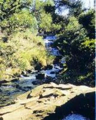
Clear rivers and soft, green valleys, waterfalls and forested ravines, sweeping plantations and exposed, grassy summits make up the Katberg.
Really a section of the Winterberg, this is a region of scenic splendour that, for many years, has been a favourite holiday destination.
Before that, it was long a scene of a bitter struggle for its possession, between colonists, supported by the British and colonial armed forces on one side, and Xhosa pastoralists-turned-soldiers on the other. A government-sponsored Khoikhoi settlement along the Kat River ended in tragedy in the 1850s, following yet another war.
There are several day walks lasting one to four hours in the vicinity of the forest station and the Katberg Hotel, and there are also the two-day Katberg Loop Trail and the two- to-three-day Katberg Hiking Trail.
Among the pine plantations are to be seen some scattered and unusual exotic trees, such as Himalayan cedar and North American redwood, among other long-lived relics of 19th-century afforestation experiments.
Baboon, vervet and samango monkey bushbuck and other small antelope may be seen, and the busy birdlife includes Knysna lourie, Cape parrot, crowned hornbill, double-collared sunbird and jackal buzzard.
The Katberg region is reached via the gravel-surfaced R351, which branches off the R67 between Fort Beaufort (30 km) and Queenstown (100 kilometres). The Katberg Pass, on which work under A G Bain commenced in 1860, provides a panoramic (but as yet untarred) route over the mountain.
